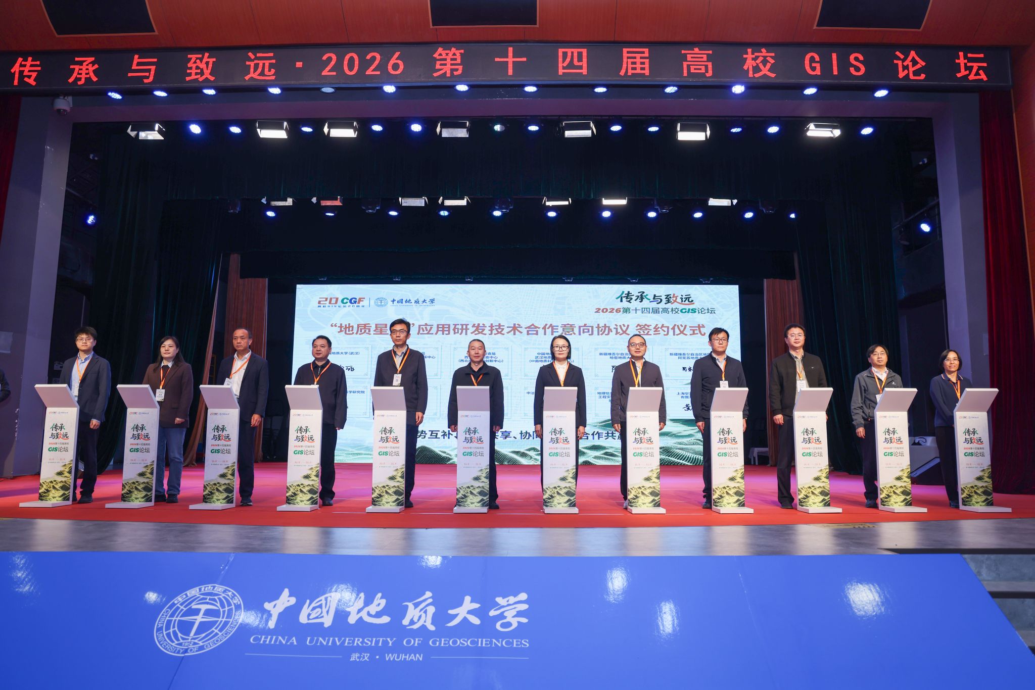
On 7 November, a signing ceremony for cooperation on the Geological Constellation (Geo-Constellation) application and development was held at China University of Geosciences (CUG). CUG, the Natural Resources Comprehensive Survey Command Center of the China Geological Survey and other institutions and enterprises signed the Framework Agreement on Technical Cooperation for Application and Development of the Geological Resource and Environment Remote Sensing Constellation, and jointly established the Geo-Constellation Application R&D Center. The partners will carry out joint technical research, operational validation and translation of results, serving the new round of the strategic action for mineral exploration breakthrough and the digital, intelligent development of geological resource and environmental survey and monitoring.
Dizhi-1 (Geology-1), China's first hyperspectral remote sensing satellite for the geology and mining sector, was developed under CUG's leadership, with Prof. WANG Lizhe as chief engineer. To meet survey and exploration needs and advance the large-scale development of the Geo-Constellation, the cooperation combines the constellation's data resources and the university's research strengths with partners' operational needs, aiming to develop satellite software products and tools for geological exploration and to strengthen intelligent geological mapping, intelligent mineral exploration and natural resources survey and monitoring. The parties will integrate satellite remote sensing data with ground survey data, subsurface exploration data and geological expertise, so that remote sensing analysis enters operational systems and is validated and applied in real missions.
Under the agreement, the parties will jointly study multi-source geological remote sensing data processing, intelligent identification of geological information and intelligent geological mapping; build an integrated above-ground and subsurface geoscience data platform; and integrate geological knowledge and mechanism-based models with artificial intelligence to support metallogenic analysis, mineral prospectivity prediction and geological hazard risk identification. They will also validate technologies and demonstrate applications through actual survey and exploration missions, turn mature results into replicable, scalable professional products and sector solutions, and train interdisciplinary talents in geology and artificial intelligence through joint projects and technical exchanges.
CUG will leverage its strengths in geoscience, remote sensing and artificial intelligence, with the National-Local Joint Engineering Laboratory for Geographic Information Systems and the Institute of Geological Survey as its main participating units, to develop new methods, models, algorithms and key technologies for intelligent geoscience analysis and to bring research into closer alignment with geological survey and mineral exploration operations.
Contributed by “CUG News”