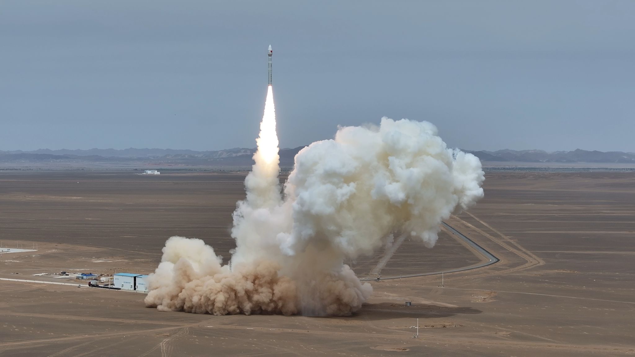
At 12:33 on May 15, the PowerChina‑1 satellite was successfully launched from the Dongfeng Commercial Aerospace Innovation Test Area at Jiuquan Satellite Launch Center and smoothly entered its predetermined orbit.
Led by PowerChina Chengdu Engineering Corporation Limited, the satellite was jointly developed by China University of Geosciences (CUG) and Spacety Aerospace Co., Ltd. ZHANG Shishu is the Chief Scientist and General Commander of the satellite project, and Prof. WANG Lizhe is the Chief Engineer.
As China’s first dedicated satellite for energy engineering, it will mainly support business needs including surface deformation monitoring of large hydropower projects, identification and early warning of potential geological hazards. The successful launch marks a new breakthrough in the professional application of space-based remote sensing for the monitoring of large regional engineering projects in China.
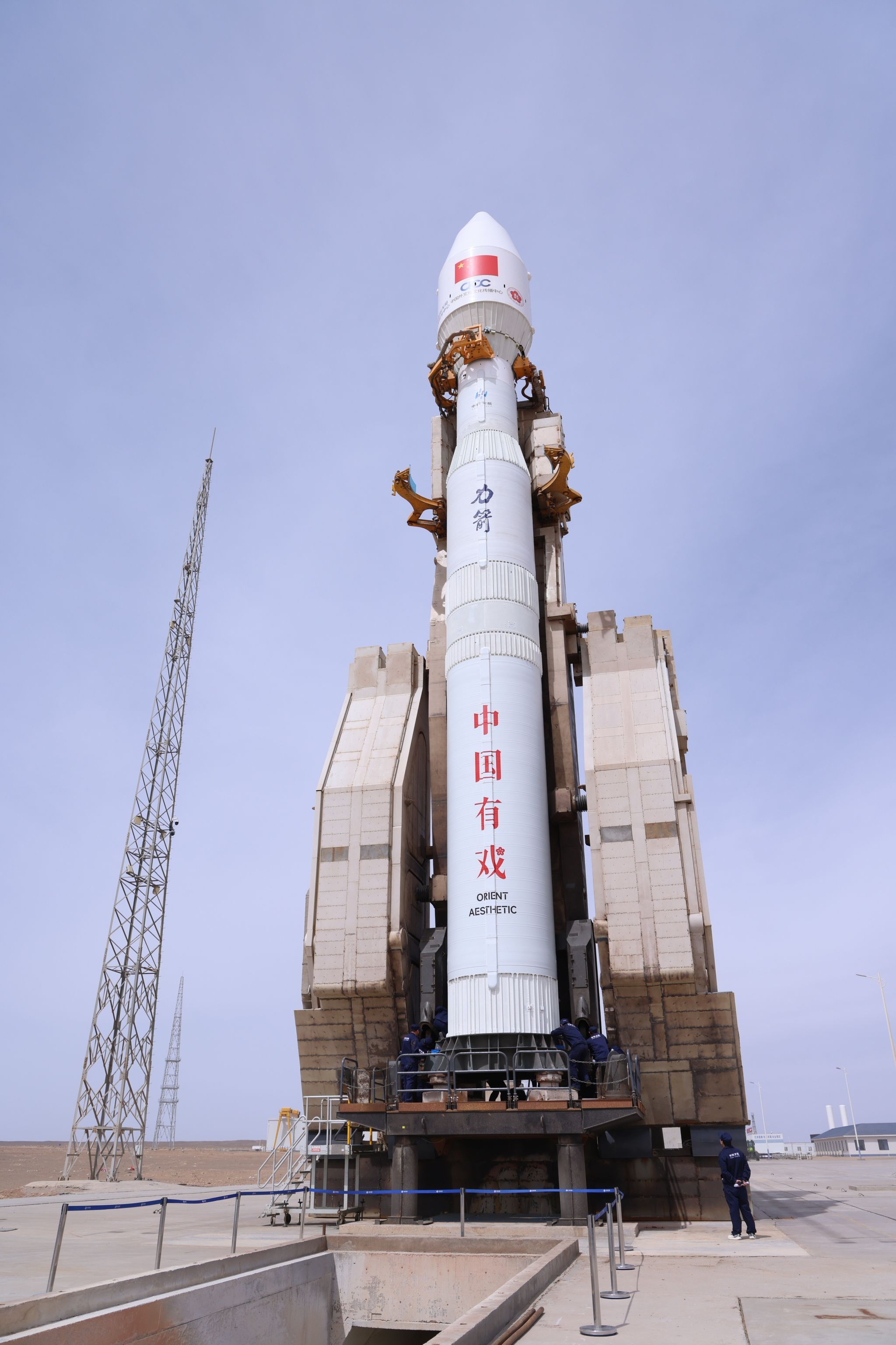
The Lijian-1 Y13 launch vehicle carrying the PowerChina‑1 Satellite
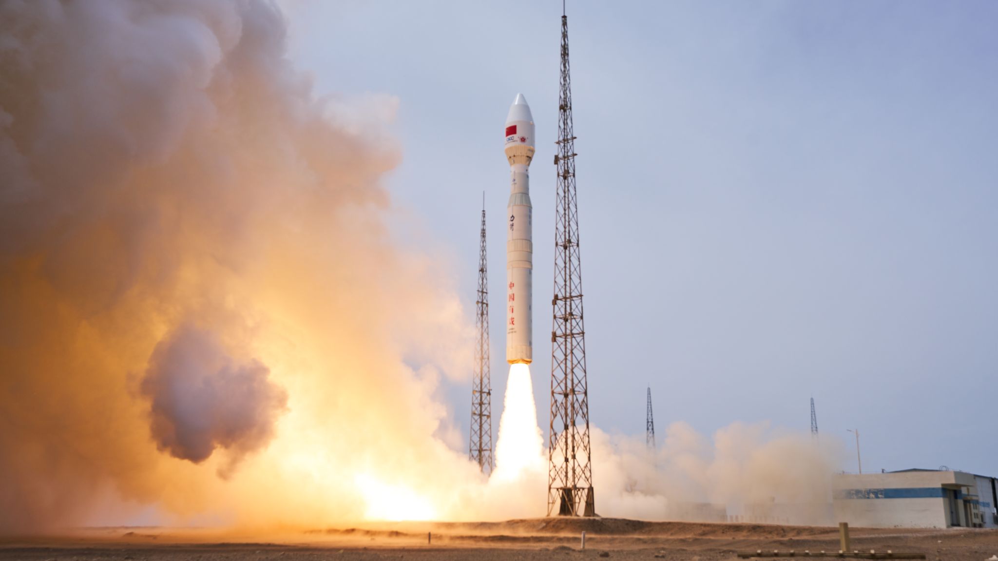
The PowerChina‑1 Satellite blasts off at Jiuquan Satellite Launch Center, China (Source: CAS Space)
The PowerChina‑1 satellite is a 300-kilogram-class small radar remote sensing satellite. It is equipped with an X-band SAR payload, operating in a Sun-synchronous orbit at an altitude of about 500 kilometers. With a designed service life of 5 years, the satellite is capable of sub-meter-level imaging at maximum and features a revisit cycle of approximately 11 days. Compared with optical remote sensing satellites, SAR satellites are less susceptible to cloud, rainfall and illumination conditions, and can realize all-time and all-weather Earth observation. They are well suited for continuous monitoring of complex terrain areas such as mountain valleys, reservoir bank slopes and major engineering construction sites.
Targeting typical application scenarios including hydropower and water conservancy projects, reservoir bank slopes, dams and surrounding geological environments, transportation corridors, and power transmission and transformation corridors, PowerChina‑1 can acquire high-resolution radar remote sensing data. By virtue of interferometric synthetic aperture radar deformation monitoring technology, satellite data can be used for identification of tiny surface deformation, evaluation of engineering safety conditions, and assessment of geological disaster risks.
Following the completion of in-orbit testing, calibration and application verification, PowerChina‑1 will support millimeter-level deformation monitoring services, offering a new technical means for the safe operation of large-scale hydropower projects under complex geological conditions.
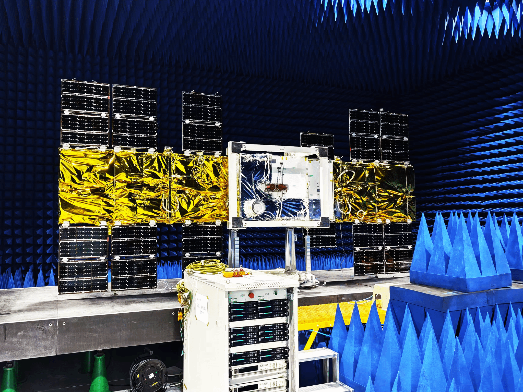
The PowerChina‑1 Satellite (Source: CAS Space)
As a major developer, CUG has relied on its scientific research accumulation in geological hazard hidden danger identification, InSAR deformation monitoring, remote sensing intelligent interpretation, and major engineering geological environment evaluation to deeply participate in the satellite’s application demand demonstration, engineering scenario sorting, ground processing and application algorithm design, and formulation of typical regional verification plans. Combining the actual needs of large-scale engineering safety monitoring, CUG’s team has integrated complex geological environment cognition, engineering deformation mechanism analysis and radar remote sensing data processing, promoting the effective connection between the satellite’s observation capabilities and engineering application scenarios.
Large-scale hydropower projects are often distributed in alpine valleys, deeply incised river valleys, reservoir bank slopes and complex structural belts, with long construction and operation cycles, scattered monitoring objects and complex types of hidden dangers. Traditional ground monitoring has advantages in point accuracy and on-site verification, but there are still deficiencies in wide-area continuous inspection, cross-regional anomaly detection and rapid post-disaster investigation. After PowerChina‑1 is put into application, it can cooperate with ground monitoring, UAV inspection, engineering management platforms and other means to improve the capabilities of major engineering hidden danger identification, risk assessment and emergency response.
Prof. WANG Lizhe, Chief Engineer of the project, stated that the development and launch of the satellite is an important achievement of the in-depth integration of earth sciences, remote sensing technology and the safety needs of major projects. Taking the satellite’s on-orbit data as the guide, CUG will continue to carry out payload calibration, geometric positioning accuracy verification, deformation monitoring accuracy verification, InSAR time-series analysis algorithm optimization and typical engineering application demonstrations, promoting high-precision radar remote sensing technology to better serve the safety of major projects and disaster prevention and mitigation.
Prof. WANG Lizhe, Chief Engineer of the PowerChina‑1 Project, introduces the satellite
It is reported that after the satellite enters orbit, the R&D team will carry out on-orbit testing, data calibration, accuracy verification and typical engineering scenario application verification as planned. Combining ground monitoring data, historical remote sensing images and engineering operation data, the team will conduct multi-source data comparative analysis on key areas, and gradually establish a stable and reliable data production process and application service model.
In the follow-up, the three parties will improve the mechanisms for satellite data acquisition, processing, interpretation, distribution and feedback focusing on key scenarios such as hydropower and water conservancy projects, reservoir bank slopes, dam areas and surrounding geological environments, construction camps, transportation corridors, and power transmission and transformation corridors, promoting the connection between satellite data and systems such as engineering project management platforms, geological disaster risk ledgers, and on-site inspection records.
After entering orbit and operating, PowerChina‑1 will continuously provide radar remote sensing observation services for large-scale hydropower project areas, offering data support for engineering construction and operation, reservoir bank slope stability evaluation, geological hazard hidden danger identification and emergency response. Taking this joint development as an opportunity, CUG will continue to give play to its disciplinary advantages in earth sciences, engineering geology and remote sensing monitoring, deepen the application of high-precision radar remote sensing technology in the safety guarantee of major projects, and contribute CUG’s strength to serving national energy security and disaster prevention and mitigation needs.